Area residents may notice a large commercial drone flying over the levee area.
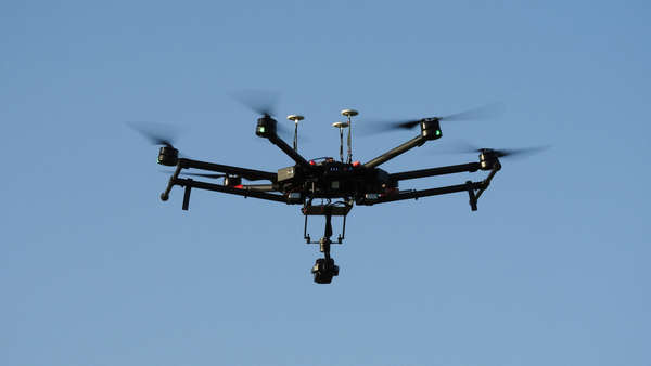
Shutterstock photo.
(Greendale, Ind.) - City of Greendale residents may notice a large commercial drone flying over the city limits as soon as next week.
Mike Hrezo, of Hrezo Engineering tells Eagle Country 99.3 that two drone flights will take place next week covering 600 acres of land in Greendale.
Hrezo Engineering is working with J&T Engineer and the Lawrenceburg Conservancy District to complete a LIDAR topography and drainage study, which is a key component for FEMA certification of the Greendale levee.
The drone flights will cover the entire levee area along U.S. 50 to the Interstate 275 and U.S. 50 interchange. One flight will focus on photographing the land, while a second flight will complete LIDAR topography.
Drone operator Dave Wingate says the drone will fly approximately 180 feet in the air, and will in no way violate the privacy of area residents.
The drone flights are weather dependent.
 Brian “Biggin” Noble Announces Official Music Video Premiere for New Single "Missin’ You"
 Lawrenceburg City Councilman Sends YES Home Youth to Kings Island
 Two Vehicles Stolen, Others Broken into in Greendale
 Indiana FFA Chapters Can Win 30 Luke Bryan Tickets, $1,000
 Franklin Co. Sheriff's Department Warns Citizens of Ongoing Scam
 Margaret Mary Health Celebrates Grand Opening of New $125 Million Hospital in Batesville