Moving forward, a smaller number of alternatives will be carried forward for detailed analysis.
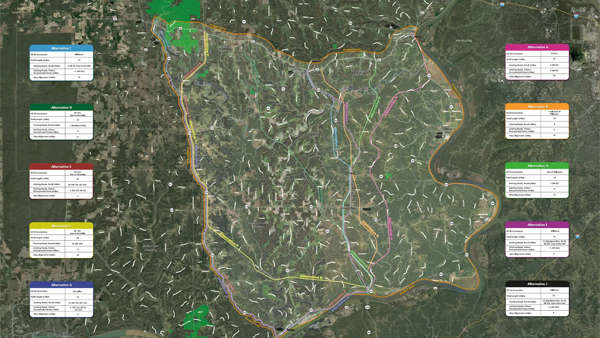
A map of 10 identified alternatives. A link to a bigger map can be found below.
(Vevay, Ind.) – Where is the most productive place to connect a new road to U.S. 50?
That is the question that has been asked numerous times over the past two years as the Indiana Department of Transportation continues to evaluate alternatives for an improved State Road 101 connection between Markland Dam and U.S. 50.
Governor Holcomb first announced $200 million in funding for the project in 2021 as part of a package of investments in southern Indiana to better connect communities and enhance commerce.
The project area includes portions of Dearborn, Ohio, Ripley, and Switzerland counties. Goals of the project include:
- Reducing travel time within the project area by improving connectivity.
- Improve safety by reducing vehicle miles traveled on roadways with elevated crash locations.
- Provide a roadway meeting current design standards.
- Provide a roadway that is above the Laughery Creek 100-year floodplain elevation and minimize the risk of slides.
Ten alternatives have been identified using key factors in development of general alignment. All start at State Road 101 at Markland Dam and consider range and destination along U.S. 50, and challenging terrain such as the Ohio River valley, steep ravines, and the Laughery Creek valley.
The preliminary alternatives avoid impacts to residences, businesses, and environmental resources, where possible, and take advantage of existing roadway corridors, where possible.
One alternative connects to U.S. 50 in Aurora. Five alternatives provide a Dillsboro connection with four using a combination of existing roads and new alignment with Laughery Creek crossings in the area of State Road 262 or Nelson Road. The other Dillsboro connection would use an all-new alignment.
Three alternatives would use portions of State Roads 156, 56 and 129 to connect to U.S. 50 near Versailles. These alternatives would give motorists options to travel through or bypass Vevay and Versailles.
The final alternative would connect State Road 101 at U.S. 50 between east of Versailles and west of Dillsboro using an all-new alignment with the exception for one mile on Markland Pike.
See the map for all 10 alternatives here.
The public comment period associated with last month’s public meetings continues through today. Share input and upload comment forms at Link101Corridor.com, email feedback to info@Link101Corridor.com or mail comments to the project office.
The project has been met with some backlash locally. Those who oppose a new State Road 101 connection prioritize homesteads and farms over freight and highways.
“We know when we talk about a new terrain roadway there are a lot of questions and sometimes there is some anxiety surrounding that, and we want to make sure that we are providing people with information and that we are being a resource. The feedback that they are providing to us absolutely matters,” said Mindy Peterson, Link 101 Public Involvement Director.
“Helping us determine the best project for your area is what we are looking for during this phase of the project. Detailed and specific feedback is incredibly helpful because folks who live here know where the issues are,” said Andy Dietrick, INDOT Major Projects Communications.
Moving forward, a smaller number of alternatives will be carried forward for more detailed analysis, which includes benefits, impacts and costs will help identify a single preferred alternative and a formal comment period will follow. The preferred alternative is expected to be identified in the draft environmental document in fall 2024. A timeline for construction will be determined at the end of the environmental study.
For more information on the Link 101 project, visit https://link101corridor.com/.

 A Summer of STREAM: Campers Soar Through Pilot Training
 Hoosier Farmers Committed to Soil Conservation
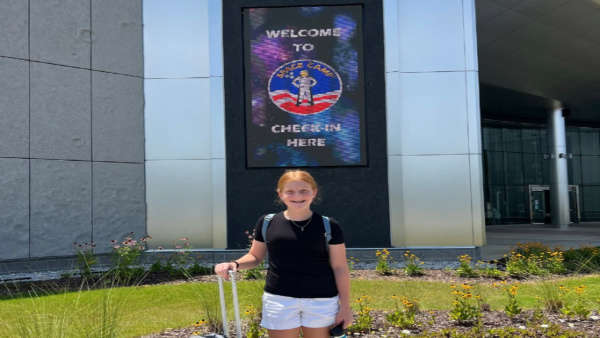 Local Student Funds Own Trip to Space Camp
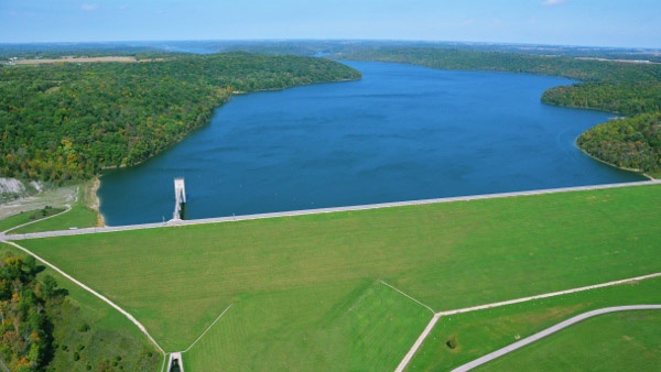 Brookville Lake 50th Anniversary Celebration Set for July 25
 Blood Drive Happens July 29 in Napoleon
 Tom Tepe Autocenter to Host Class Act Carnival

