Flooding caused by excessive rainfall is possible.

Shutterstock Photo
(Tri-State Area) - According to the National Weather Service, Wilmington Ohio a flood watch will go into effect from Wednesday through Sunday evening.
A boundary will cross the region on Wednesday night, creating significant rainfall with a round of thunderstorms developing along it. On Thursday, this boundary will lay out along the Ohio River and linger through Saturday. Waves of energy will interact with a deep layer of moisture along the stalled surface front. The front begins to show a movement to the southeast Saturday night, marking the end of any significant rainfall. The heaviest rainfall will notably occur during the overnight hours through the end of the week.
This affects the following Indiana counties: Franklin, Ripley, Ohio, and Switzerland. Affected Northern Kentucky counties include Boone, Kenton, and Gallatin. Ohio Counties include Butler, Hamilton, and Clermont.
Soils remain moist and excessive runoff may result in flooding of rivers, creeks, streams, and other low-lying and flood-prone locations.
 Ripley County K9 Wins Multiple Awards
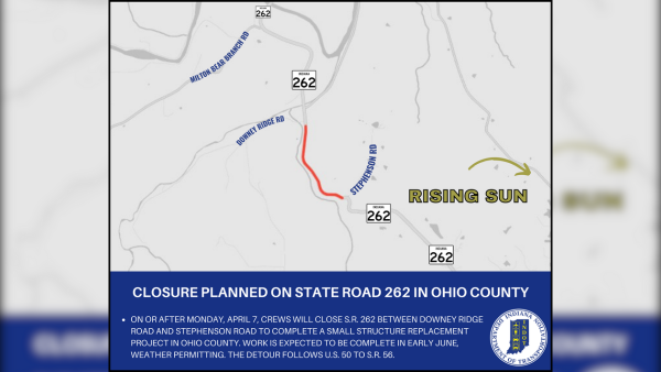 Closure Planned on State Road 262 in Ohio County
 Lane Closure On I-275 Next Week
 Ongoing Investigation for Recent Break-In at Manchester Market
 Colonel Les Hill Appointed as Boone County Sheriff
 South Dearborn Business Professionals Fundraiser at Aurora Chipotle