A funnel cloud was reportedly witnessed by law enforcement in Jennings County Tuesday night.
A possible funnel cloud seen Tuesday night in Jennings County. Amanda Littrell photo shared to WRTV Indianapolis.
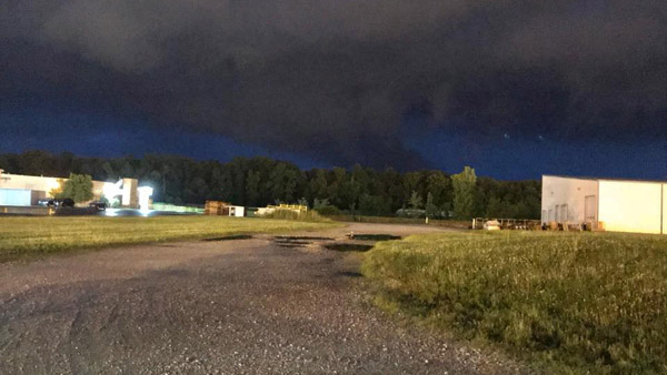
(Ripley County, Ind.) - Some strong storms caused some tense moments late Tuesday night.
A tornado was at one point believed to have touched down near Butlerville in Jennings County just after 10:00 p.m. The National Weather Service has not confirmed whether it was indeed a tornado.
Tornado warning has been issued for a portion of Jennings County covering much of the area to the northeast of North Vernon. This warning includes the towns of Butlerville, Muscatatuck, and Nebraska. Law enforcement spotted a tornado near the town of Butlerville. #INwx #nwsind
— NWS Indianapolis (@NWSIndianapolis) June 13, 2018
No major damage reports were received after the storm blew into Ripley County.
The storms did bring some heavy rains, which triggered a flash flood warning and caused part of State Road 262 to flood overnight.
By Wednesday morning, Southeastern Indiana REMC and Duke Energy were reporting a miniscule number of power outages in the tri-state.
A chance of thunderstorms remains in the forecast Wednesday afternoon into the evening, according to the National Weather Service forecast. Skies are expected to clear for the later part of the week and into the weekend.
 Napoleon State Bank Announces Retirement of Former President, Board Member
 Indy Woman Identified as Victim of Fatal Crash on State Road 56
 New Patient Care Manager Named at Our Hospice of Jennings County
 Arrest Made in Green Township Road Rage Incident
 Ripley Co. Highway Dept. Urges Motorists to Watch Out for Mowing Crews
 Middle School Student Found with Pocket Knife Facing Disciplinary Action